For over a decade, RTR has been at the forefront of delivering high-quality surveying and drone and survey, project oversight, outage and constructibility, and environmental services for utility infrastructure projects. Our partnership with PPL Electric Utilities and other major providers reflects our dedication to precision, efficiency, and industry-leading technology. With a strong team of professionals specializing in transmission, distribution, and field surveying, RTR ensures that every project aligns with safety standards, regulatory requirements, and client expectations.
PPL Electric Utilities: High-Resolution LiDAR Surveys for Enhanced Infrastructure
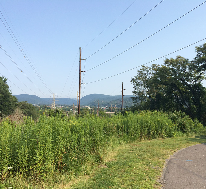
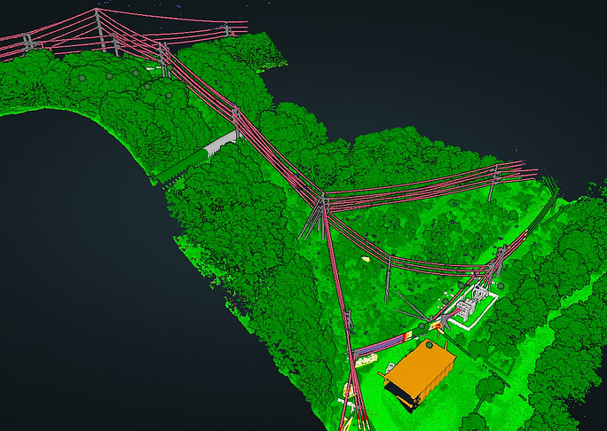
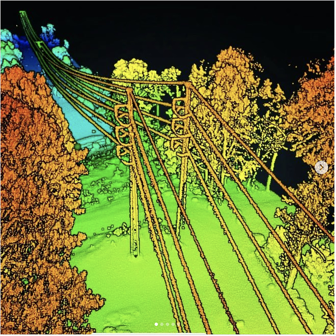
RTR’s commitment to innovation was exemplified in our recent work with PPL Electric Utilities, where we conducted a high-resolution LiDAR survey at the Wallenpaupack Hydro Dam. Our team utilized drone-based LiDAR technology to capture detailed point cloud data, allowing for the identification of existing structures and potential interferences. The entire fieldwork phase was completed in a single day, with full point cloud classification delivered within one week. The seamless integration of our data into PPL’s transmission design workflow underscores RTR’s ability to provide accurate, utility-ready geospatial insights under tight project timelines.
Atlantic City Electric: Efficient Stakeout and Surveying for Infrastructure Development
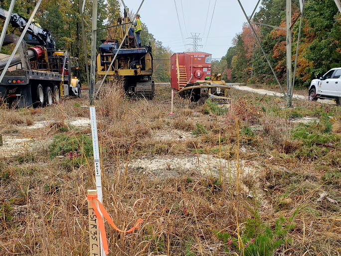
Another key project that highlights RTR’s expertise was our structure and offset stakeout services for Atlantic City Electric’s (ACE) B.L. England to Corison 138 kV Transmission Line Rebuild in Cape May County, NJ. Our team played a pivotal role in supporting MJ Electric’s construction crews by providing precise layout services for multiple foundation types, including concrete drilled shafts, steel caissons, and helical pile foundations. Thanks to RTR’s embedded utility survey knowledge and ability to respond to real-time field adjustments, the project stayed ahead of schedule while optimizing costs for our client.
PSE&G Transmission Sagging: Ensuring Accuracy for System Reliability
Precision and attention to detail were essential in RTR’s work with PSE&G for the Active and Verification Transmission Sagging of the Roseland to Lambertville 230 kV Rebuild. Our team supported Mastec field crews by verifying conductor sagging along multiple segments of the 90-span rebuild. RTR also played a critical role in reconciling discrepancies between fixed-wing LiDAR data and terrestrial survey data, ensuring accurate validation and reporting for the transmission system upgrade.
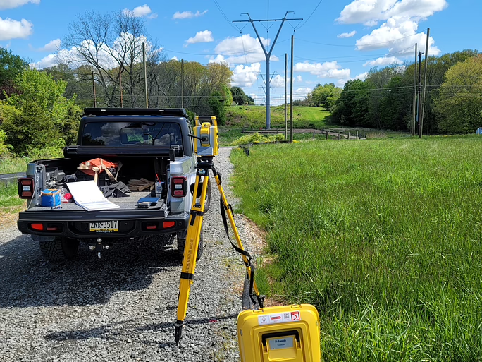
Our Expertise and Commitment to the Utility Sector
RTR’s extensive experience in utility infrastructure projects—ranging from transmission line rebuilds to topographic and boundary surveys—demonstrates our ability to adapt to complex field conditions while maintaining a commitment to precision and efficiency.
Our expertise in LiDAR surveying, environmental permitting, and real-time field adjustments makes us a trusted partner for major utility providers. As we continue to expand our capabilities and refine our methodologies, RTR is ready to tackle the next generation of infrastructure challenges with the same level of accuracy, innovation, and responsiveness that have defined our work for over a decade.
Citations & References
- U.S. Geological Survey (USGS). (2023). LiDAR (Light Detection and Ranging) Technology. Retrieved from https://www.usgs.gov
- National Oceanic and Atmospheric Administration (NOAA). (2024). LiDAR and Remote Sensing Applications for Coastal Infrastructure. Retrieved from https://www.noaa.gov
- American Society of Civil Engineers (ASCE). (2023). Surveying and LiDAR Technologies in Infrastructure Projects. Retrieved from https://www.asce.org
- Geospatial World. (2024). LiDAR Technology and Its Applications in Utility Infrastructure Development. Retrieved from https://www.geospatialworld.net
- PPL Electric Utilities. (2023). PPL’s High-Resolution LiDAR Surveying for Transmission and Distribution Infrastructure. Retrieved from https://www.pplweb.com
- Atlantic City Electric. (2023). B.L. England to Corison 138 kV Transmission Line Rebuild: Stakeout and Surveying. Retrieved from https://www.atlanticcityelectric.com
- PSEG. (2023). PSE&G Transmission Sagging Verification and Utility Infrastructure Projects. Retrieved from https://www.pseg.com
- Environmental Protection Agency (EPA). (2023). Environmental Considerations in Utility Surveying and Permitting. Retrieved from https://www.epa.gov
- LiDAR News. (2024). Advances in LiDAR Technology for Utility and Infrastructure Projects. Retrieved from https://www.lidarnews.com
- Journal of Surveying Engineering. (2023). Surveying Methods for Infrastructure Projects: LiDAR, GPS, and Conventional Techniques. Retrieved from https://ascelibrary.org